Sleepy Norwood in the Northwest Bronx has been identified as the next possible hot New York City neighborhood.
But, not for another 50 years.
TimeOut New York decided to make an “educated” guess as to which neighborhood would be hot in 50 years and all signs pointed to Norwood according to a recent article.
We spoke with Warburg Realty agent Kemdi Anosike to get an idea of what sort of infrastructure an area needs to flourish. For the most part, according to Anosike, people are looking for exactly what you might expect: affordability, space, safety and proximity to transportation. The main feature that potential buyers and renters want in a neighborhood? “Parks,” he says. “For the longest time, people have always wanted to be close to the park, no matter which one it is.”
With those parameters in mind, we turned to a 2013 study by the Department of City Planning to gain some insight. That document projects that, through 2040, New York City’s population will grow by 9 percent, with the Bronx boasting a robust 14 percent growth; in the same period, that borough is expected to add 72,000 housing units. In other words, the Bronx is really going to blow up over the next 50 years.
Finding a good deal in the South Bronx is already becoming difficult, but a nabe a bit farther north, like Norwood, seems perfectly poised to peak in about a half century. Right now, housing prices are quite affordable there—in 2017, the median home price was $358,000, according to StreetEasy—so it’s currently in the sweet spot.
A lot can happen in 50 years. Heck, a lot can happen in a few months that would change any of these “predictions” but as gentrification and development continues to creep outwards from Manhattan, it’s only a matter of time before the rest of the borough and NYC is swallowed up.
The Nonhuman Rights Project filed a lawsuit earlier this week to free the 47 year old Happy the Elephant from The Bronx Zoo where she’s been held in captivity for most of her life since the 1970s.
According to the group, they allege (and are probably quite correct) that Happy is unhappy given the fact that elephants are social animals who live in social groups and she’s alone at the zoo.
They also walk 20 miles a day in the wild but that’s something she doesn’t even get a fraction of.
For much of her life, Happy did have a partner—Grumpy, another Asian elephant who was captured along with five other calves in the 1970s, and eventually landed with Happy in the Bronx. But the zoo’s two other remaining elephants, Maxine and Patty, charged Grumpy in 2002, fatally injuring her and leaving Happy all alone. Happy was then briefly paired with a young elephant named Sammy, who soon after contracted a liver disease and was euthanized—the zoo’s third elephant death in just four years, according to the Times.
In the past, animal advocacy groups have accused the Bronx Zoo of mistreating its elephants, citing cold winters and cramped cages, as well as Happy’s isolation. But the zoo has countered that Happy shows “no signs of physiological or psychological stress,” and maintains a close bond with her caretakers. Abruptly severing that bond by sending Happy to an animal sanctuary could be traumatic, according to the zoo’s conservationists.
“The Nonhuman Rights Project is exploiting the Bronx Zoo elephants to advance their own failing cause in the courts as they put forth ludicrous legal arguments and lies about our elephants, facilities and staff,” Bronx Zoo Director Jim Breheny said in a statement to Gothamist.
We do believe that Happy is attached to her handlers so any decision would have to be cautious in helping her situation if she does get her freedom. What would that mean for Happy who’s attached to her humans and they’d have to be separated?
The answers we think we know aren’t always clear.
Whatever happens, let’s hope Happy ends up truly Happy.
We are currently experiencing intermittent outages on our website which you may have noticed over the past couple of days.
The reason? Thanks to you, we are growing faster than anticipated and have had to upgrade our server capacity several times this year.
This is a problem we would encounter just once a year with steady growth but 2018 has proven to be a landmark year for Welcome2TheBronx.
None of this could have been done without our loyal readers like you so thanks for crashing our servers!
Our web department says we should be running smoothly now but if you experience any hiccups and/or slow downs, do know that we are working diligently to make sure your experience on our site is great!
Applications are now being accepted for a new affordable housing development for seniors in the West Farms neighborhood of The Bronx.
Located at 1880 Boston Road just one block south of the West Farms/East Tremont subway station on the 2 and 5 train, the 10 story development features 14 studio apartments and 44 one bedroom units.
Amenities include on-site social services, a computer lounge, yoga room, fitness center, community room, laundry room, and even an arts and crafts room.
Qualifying applicants must have at least one household member who is 62 years of age or older and meet the income requirements which, under the Extremely Low and Low Income Affordability Program (ELLA) is from $0 to $36,550 for a one person household and $0 to $41,750 for a two person household.
All eligible tenants are required to qualify for Section 8.
With the L-pocalypse just 15 months away as shutdown of the L train creeps closer renters choosing not to hunker down for the 15 month in Williamsburg and Bushwick are already looking for alternatives.
Mott Haven in The Bronx has been listed as a somewhat comparable neighborhood to Bushwick (along with Chinatown and Red Hook) for those seeking relief from lack of subway service for over a year.
“The South Bronx waterfront, where hip-hop was born, is booming with new construction as thousands of units are expected to come on line in the next years,” Halpern said. “An influx of new residents are expected as are amenities, retail and much-needed city investment in infrastructure and services. No wonder this has been regarded for some time as one of the hottest neighborhoods in New York.”
HOW IT STACKS UP IN OTHER WAYS:
Longer commute.
It takes a bit longer to get Downtown. Theaverage commute time to the Financial District is 56 minutes compared to Bushwick’s average commute time of 43.5 minutes. But that longer commute could score you lower rent.
This mural in Mott Haven from three years ago seems to have foretold what’s coming with the L-pocalypse
Fledgling restaurant and bar scene. Trendy spots along the South Bronx waterfront include the Bruckner Market food hall, a former warehouse that will resemble Chelsea Market with a rooftop beer garden and a variety of takeout and sit-down restaurants. Harlem’s Milk Burger, a gourmet burger joint similar to Shake Shack, opened in late 2016. It joined spots like Filtered Coffee, Charlie’s Bar & Kitchen, Ceetay Sushi, and the Italian restaurant La Grata.
The upscale pub at Port Morris Distillery recently opened on East 133rd Street and the Bruckner Market may also house a microbrewery. Together, with Tirado Distillery and Bronx Brewery, there’s a burgeoning craft beer/distillery scene. Creative commercial space coming by 2019. A large new development on the Third Avenue waterfront will include 20,500 square feet of retail space and 1,100 square feet of community facility space. Other commercial developments are aimed at attracting tech and design tenants.
New LGBTQ community center opening in neighboring Melrose.
This center will be one of the few hubs of LGBTQ services and programming in the Bronx. Slated to open shortly in The Hub shopping district, it will offer a wide variety of health and human services and work to address issues like job training, bullying, housing, and arts and culture.
More open space than Bushwick.
Mott Haven got higher marks for access to open space than Bushwick. The neighborhood’s St. Mary’s Park is getting a much-needed overhaul, with construction finishing in late 2019. Its rec center will be reconstructed by mid-2019, and the Parks Department plans to add new programming and activities. A partly vacant playground will get new basketball and tennis courts, play equipment, seating areas, and new landscaping by around the same time.
The L-pocalypse won’t be just harming Brooklyn but will simply help speed up gentrification in the outer boroughs as thousands flee from the shutdown.
Read the full story and see which other neighborhoods made the list over at Localize.city.
The transformation of the Sheridan Expressway from a highway to a tree-lined boulevard just took a leap closer to becoming a reality.
The federal government has given the green light for removing the designation of the expressway as an interstate which will allow the state to proceed with plans to convert this stretch of road in The Bronx into a boulevard.
This will remove the barrier that is the little used roadway and provide easier and safer access to the Bronx River and surrounding greenways.
While this is all nice and looks cute on paper, the problem still remains of where to place the ramp into Hunts Point.
The Cuomo administration insists on placing the ramp at Edgewater where it will cut of communities and cause more pollution in an area that is saturated with heavy truck traffic already.
It literally defeats the point of tearing down the Sheridan and is a slap in the face to the community. A literally “We don’t care” from Cuomo.
Oakpoint is where the ramp needs to go which will allow for direct truck access into the industrial heart of Hunts Point and not running through its residential core further exacerbating deadly conditions.
So thanks for the cute renderings but they’re worthless in the face of potential lives lost if the ramp is placed on Edgewater.
According to Curbed, construction on the $75 million Sheridan plan is expected to begin by the end of this month.
Now that the Soundview Ferry service is in full swing, the New York City Economic Development Corporation needs your input on where to look into for possible future ferry landings in The Bronx and across the city.
We have already written several pieces on what a future expansion could look like so we’re glad that we’re being given an opportunity to officially voice our opinion on the matter.
This is an excellent opportunity for residents of the East Bronx, particularly in Throggs Neck, Country Club, and City Island to push for such a service should they want it in their backyards.
It’s also an excellent opportunity for South Bronx residents to fight for additional services that will help alleviate the situation on our transit options which are crumbling at the moment.
Personally, we feel one of the best recommendations we can make is a direct service into Queens and Brooklyn skipping Manhattan altogether.
It looks like you can make multiple suggestions (for now) so take full advantage!
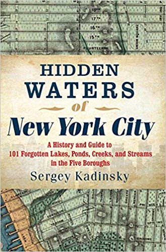
The following was originally published over at Hidden Waters Blog, a companion blog to the amazing Hidden Waters of NYC book by Sergey Kadinsky, and reprinted with permission.
Among the streams feeding into the East River that flow through the Bronx, Pugsley Creek is obscure, with little information available on its history. All that remains of it today is an inlet of the East River that used to penetrate much further inland.
The present head of this stream is deep inside Pugsley Creek Park, a 50-acre sanctuary of plants and wildlife separating the Soundview and Castle Hill neighborhoods.
Where it Flows
Prior to urbanization Pugsley Creek originated from several sources in the Soundview section of the Bronx, gathering together into a winding stream that widened into a salt marsh on its way to the East River. The route of Soundview Avenue predates the street grid, running atop the spine of Cornell’s Neck towards Clason Point. As with these two names, Pugsley was a landowner in this area in the 19th century. The name also appears on Pugsley Avenue that runs through the area. On the neck between Pugsley Creek and Westchester Creek, today’s Castle Hill appeared on the 1891 Joseph Bien map as Unionport. Its grid would eventually cover much of southeastern Bronx.
The 1941 Barkan Street Directory map shows the planned grid in its entirety mashed with the natural courses of Bronx River, Pugsley’s Creek and Westchester Creek. A trolley line runs down Soundview Avenue and the elevated subway line atop Westchester Avenue. In yellow I marked Eastern Boulevard, the forerunner of Bruckner Expressway, which touches the headwaters of Pugsley Creek.
Progress on Pugsley
This slideshow requires JavaScript.
Using the aerial surveys available on the DoITT NYCity Map, I compered the landscape around Pugsley Creek in 1924, 1951, and 1996. Lacombe Avenue, which today marks the innermost extent of the stream is marked in yellow. What was a rural retreat of farms and amusement parks in 1924 was being filled in 1951 in anticipation of development. On the east side of Ferry Point, Baxter Creek Inlet was entirely filled in favor of a proposed beach. Instead the landfill here lay unused until the Trump Organization stepped in to clean it up in favor of a golf course.
By 1996, Pugsley Creek assumed its present shorelines. On the inland side of Lacombe Avenue are superblocks atop the landfill that host Adlai E. Stevenson High School and its athletic field, Stevenson Commons apartments, and P. S. 182.
Since 1996 the empty lots atop the filled creek have been covered by residences but on Bolton Avenue there’s still an undeveloped block whose presence relates to Pugsley Creek.
On this expanse of superblocks the former Newman Avenue is marked as Stickball Boulevard. During the summer the street is closed to vehicles on Sundays and reserved for “poor man’s baseball” of a sawed-off broomstick and Spaldeen handball. The sport dates to the prewar years of the inner city, before the eponymous Stickball Boulevard existed. The street is co-named for stickball aficionado Steve Mercado, a firefighter killed on 9/11.
Pugsley Creek Park
The acquisition of remaining land along Pugsley Creek Park into a park occurred in piecemeal fashion. A trail was dedicated in this park in 2009. There is not much else to do here besides biking, walking and bird watching. The entrance to this trail is on Lacombe and Pugsley Avenues.
One more map: a 1975 planning chart that shows the park’s borders. Note the dead-end knob off Lacombe Avenue. That’s a piece of Barrett Avenue with a couple of addresses on it that was developed while everything around was empty. That’s how this piece of Barrett was preserved while the rest of this mostly planned street was demapped and absorbed into the park. At the head of Pugsley Creek were a proposed sewage treatment plant. It was instead built at Hunts Point.
Inside the park it is easy to spot where the stream flowed in the form of ravines. Unfortunately there are still too many discarded tires and shopping carts littering this “forever wild” preserve.
The vines and tree branches of the ravine widen into a salt marsh that floods in high tide. salt marsh cordgrass and phragmites are the dominant plants here. Is this land or water? Between the two categories, this is a wetland.
In turn the salt marsh widens into a visible stream. At sea level this surface section of Pugsley Creek is really an extension of East River with little water flowing into from the historic Pugsley Creek watershed. There is one Combined Sewer Outfall (CSO) pipe that discharges into the creek in the event of heavy rainfall.
Near Castle Hill Point is a scenic staircase descending to the creek. Such a structure is more recognizable on an upscale waterfront estate but this is a public park and anyone can sit on its steps and admire the view. Behind the stairs is Pugsley Creek Park and in the foreground is Castle Hill Park.
Best of all, the entrance to this staircase includes an informational sign about the creek and its native wildlife. The sign depicts the native wildlife: canvasback duck, fiddler crabs, ribbed mussels, and snowy egrets. The sign was installed as part of a city-state salt marsh restoration project during the Bloomberg administration. Between 1928 and 1985 land at the tip of Castle Hill was the site of Castle Hill Beach Club. Like nearby Shorehaven, this was a private resort that had a sizable pool but did not have an actual beach on the creek.
On Facebook former members of the club share photos and memorabilia spanning three generations. Above, group administrator Marc Miller made a collage for Castle Hill Beach Club. By the time that the club had closed in 1985, Pugsley Creek was sorely in need of restoration as runoff and illegal dumping had degraded the once-pristine waterway. At the turn of the millennium the site of the club was developed as tract housing, giving a suburban look to this corner of the Bronx.
In the view above towards the tip of Castle Hill, we see the East River and Clason Point on the right side. Across the East River in the background is Queens. On the eastern side of Castle Hill Point facing the mouth of Westchester Creek, the Bronx YMCA maintains its waterfront presence. Like old beach clubs nearby, it also had an outdoor pool overlooking the East River. To continue along Westchester Creek, you can read my history article on it, or Nathan Kensinger’s Curbed photo essay on the stream.
Sergey Kadinsky is the author of Hidden Waters of New York City: A History and Guide to 101 Forgotten Lakes, Ponds, Creeks, and Streams in the Five Boroughs (2016, Countryman Press) and the webmaster of Hidden Waters Blog.
He is a licensed tour guide who paid his way through college atop the double-decker Gray Line buses.
Kadinsky is a contributor to Forgotten New York, a local history website. His articles on the city’s history appeared in New York Post, New York Daily News, and Queens Chronicle, among other publications.
Read more fascinating New York City history in Sergey Kadinsky’s book! (click to purchase)
The construction boom across NYC and The Bronx is rapidly transforming our borough and now a new report shows that the South Bronx neighborhood of Melrose had more new residential units approved than any other in the borough.
In fact, Melrose placed third in New York after Long Island City and East New York according to a new report by Localize.city.
Between July 1, 2017 and July 1, 2018, a total of 1,027 units were approved in Melrose as per the report which indicates that these units are slated to open starting 2021.
Bronx Common’s Bronx Music Heritage Center which is under construction in Melrose
During the last census in 2010, Melrose was identified as the third fastest growing neighborhood in New York City and that doesn’t seem to have let up so it will be interesting to see what happens in the upcoming census.
Just take a walk through the neighborhood and you’ll see cranes and construction sites everywhere including the massive La Central which will have just under 1,000 units and Bronx Commons which will house the Bronx Music Heritage Center.
As for the rest of the borough, seven of the top twenty neighborhoods on the list were in The Bronx and are as follows:
Melrose, 1,027
Mott Haven, 733
Crotona Park East, 731
East Tremont, 705
Longwood, 560
Bedford Park, 470
Tremont, 417
La Central, currently rising, will have just under 1,000 residential units spread across 5 buildings from Westchester Avenue to 153rd Street.
Just these neighborhoods alone have 4,643 units that have been approved during that cycle, greatly adding to the inventory in our borough.
Localize.city reports:
Bronx is ascendant
All of the neighborhoods Localize.city identified as seeing the biggest uptick in permits this year — in addition to East New York — were in the Bronx. Bedford Park, for example, saw more permits filed in the first half of this year than in all of 2017.
From 2010 through 2015 (including 2015), about 13 percent of the city’s approved residential units, on average, were in the Bronx. Drilling down further in this time frame, in 2014 and 2015, only about 8 percent of the approved units were in the Bronx. However, since 2016, the borough saw its share of construction bloom. The number of approved units in the borough jumped to more than 23 percent in 2016; in 2017, the Bronx had 24 percent of the approved new units; and in the first half of 2018, it had 27 percent of the approved new units.
“Here’s another way to look at the shifts: over the last 2.5 years, about 12,000 units were approved in the Bronx, which is roughly the same as in Manhattan,” Schwartz said. “For reference, in the six years between 2010 through 2015, Manhattan had almost triple the number of approved units: 38,580 compared to the Bronx’s 13,438.”
We’ll certainly see these numbers increase considerably once developers begin redeveloping swaths of the Jerome Avenue Rezoning Area as well as over in Mott Haven’s Lower Concourse Rezoning Area in Mott Haven which is heating up.
The character of our borough is changing and while some say it’s for the best, we don’t necessarily buy into that.
Bronxites who need the affordable housing the most that’s being constructed aren’t the ones qualifying.
Now residents are complaining that they’re having a rough time finding parking.
The problem stems from the fact that the ferry was designed for people who live in the immediate area in Clason Point and Soundview with the assumption that people would walk or take the BX 27 Bus which was extended earlier this year to drop off commuters at the landing.
But the city should have invested in creating a parking lot for those commuters who would be driving in rather than biking or taking the bus.
Let’s face it: With the subway system in less than desirable conditions and poor transit options in the East Bronx, this was bound to happen due to demand.
Right now the New York City Ecominic Development Corporation will be investing in bike racks and while that thought is noble and does address the needs of one segment of the commuting population, it neglects those with cars.
On the second day of ferry service last month, Welcome2TheBronx received complaints that people had to drive back home after unsuccessfully circling for parking.
Those that do find it take away the few spaces available for local area residents.
“It’s not the ferry, its the heavy construction happening around there that have eliminated many parking spaces.” said one individual on News 12 The Bronx’s Facebook page.
Another commenter by the name of HR Ortiz added, “The Ferry has nothing to do with the parking problems in Clason Point. The parking situation has been terrible for a very long time before the Ferry arrived.”
Ortiz went on to say that, “It might of added a little more problems to the parking situation but that’s all it did. The parking spaces are actually being rotated a lot more than before. The residents in the neighborhood are a little upset that they can’t hog up the spaces.”
Whatever the situation is, the solutions offered aren’t what the people want.
The controversial planned 1,300 luxury development along the Harlem River Waterfront in the South Bronx’s Port Morris neighborhood is now slated to include “affordable” housing.
But affordable for who?
Spread across seven buildings at the foot of the Third Avenue Bridge at 2401 Third Avenue and 101 Lincoln Avenue, the development has still yet to make progress but now it seems that construction is imminent as Brookfield Properties purchased the development site from Somerset Partners and The Chetrit Group, the original masterminds behind the “Piano District” failed rebranding.
According to the Real Deal, construction is set to begin next year by the second quarter of 2019.
It will be interesting to see how quickly they can fill up these units considering that 25 Bruckner has been on the market for over a year now and it is still not near 100% occupancy.
Getting renters to pay thousands of dollars and having to walk over 5 blocks to the nearest subway and cross under a highway may be a tough sell for many.
As for the affordable component we already know that it’s not affordable to the overwhelming majority of existing residents but to make matters even worse, developers have the option to offer the “affordable” portion of units up to 130% of the inflated Area Median Income (AMI) which will most certainly push them out of the realm for pretty much everyone in the South Bronx.


 Amenities include on-site social services, a computer lounge, yoga room, fitness center, community room, laundry room, and even an arts and crafts room.
 All eligible tenants are required to qualify for Section 8.


 According to the